
Coming soon
NextSimFlight V2.0 is on final
For a while now I have been working on a new design and 20+ new features. Here is a first look at what is about to land.
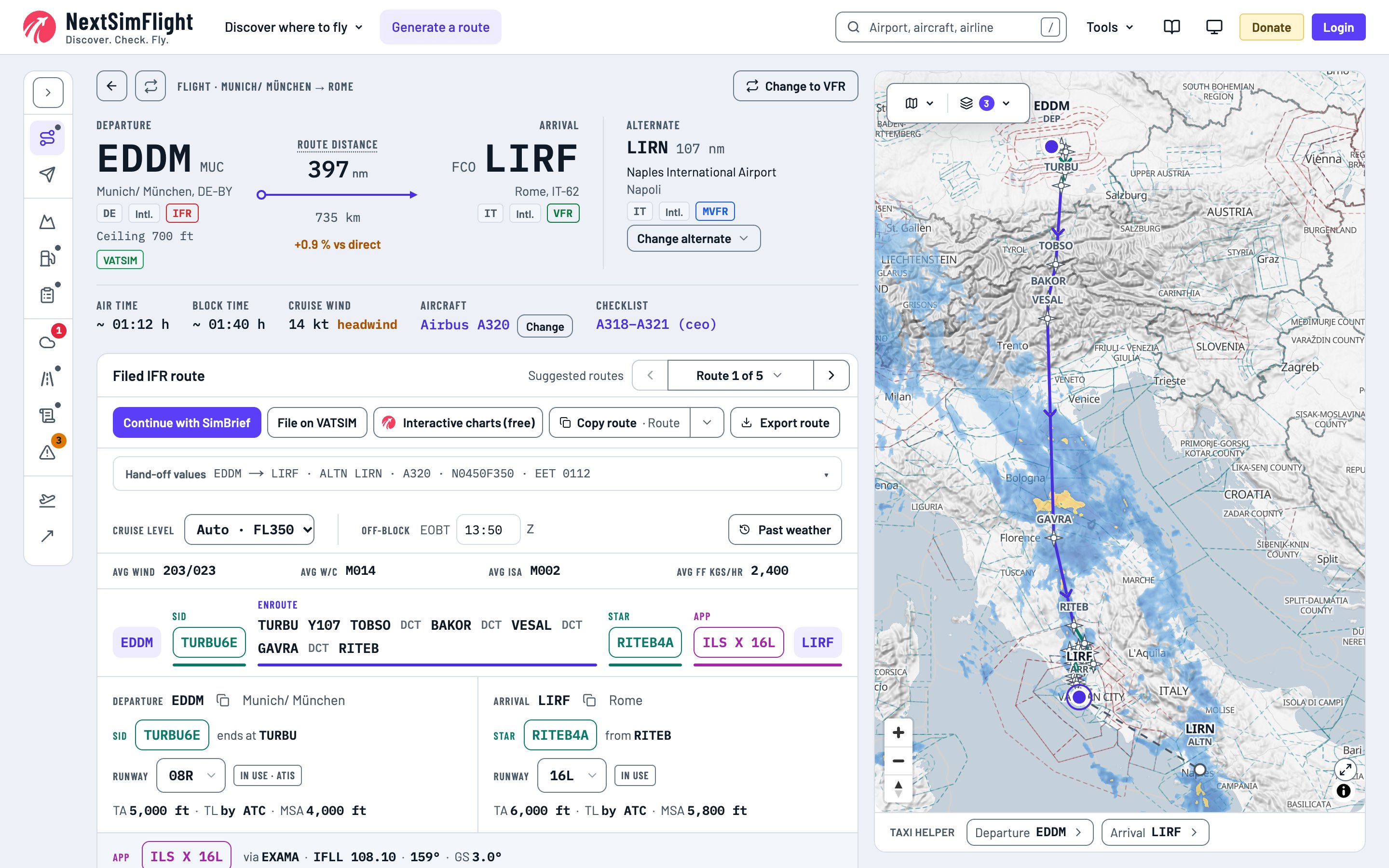
New Design
Your whole flight now fits on one page. Route, fuel, weather and charts sit side by side, and the map stays in view while you work. SIDs, STARs and approaches are drawn to the runway in use, and your flight goes to SimBrief or VATSIM in one click.
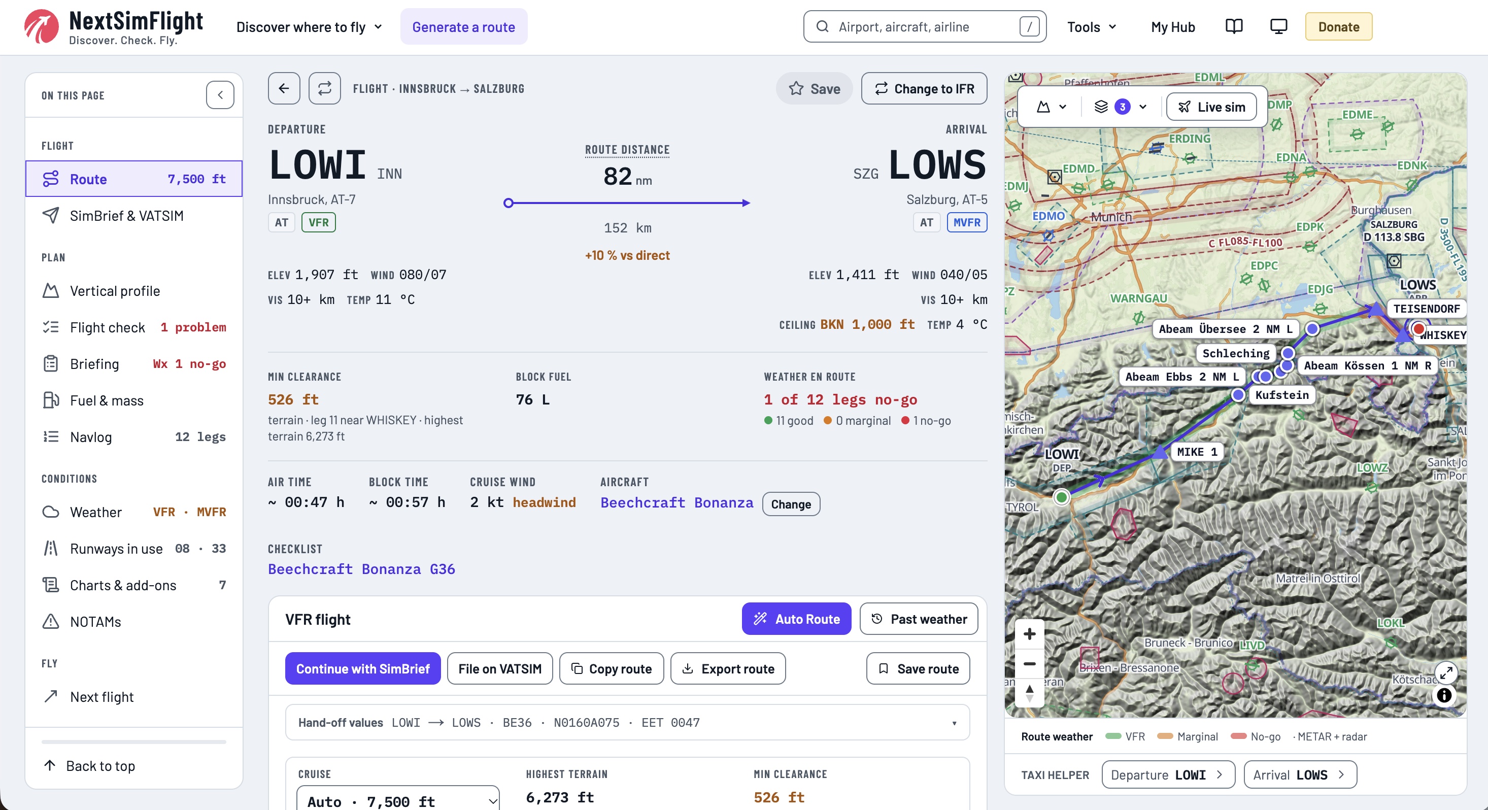
A full VFR planner
Auto Route plans around airspace and terrain and suggests a level for every leg. You get a briefing, a navlog and a PDF to take along, and you can edit every waypoint right on the map.
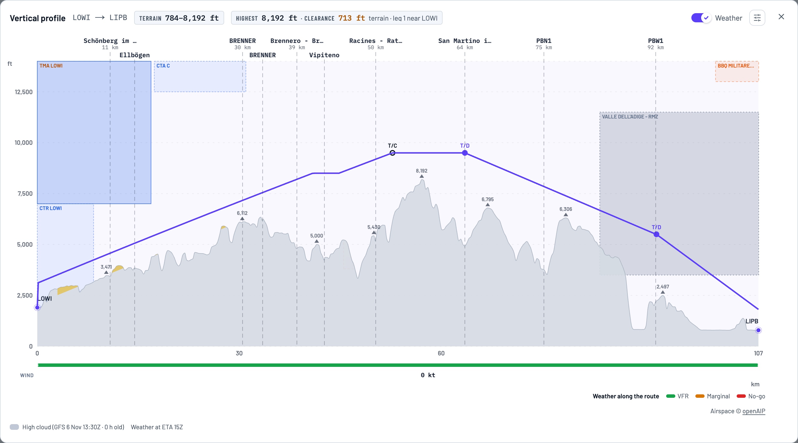
Vertical profile
See every flight from the side, VFR and IFR: terrain, airspace, clouds, weather and wind along your route, with top of climb and top of descent. On VFR routes you can drag a level right in the profile.
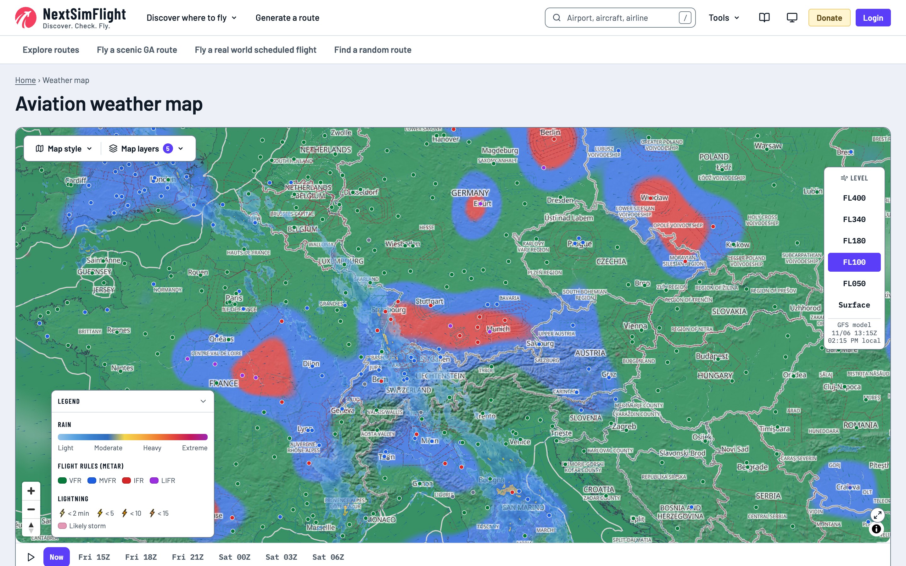
Live weather map
Weather tiles and calculations are NextSimFlight's own, built on public weather data: rain radar, clouds, METAR stations, flight rules areas and lightning on one map, plus wind, turbulence and icing by flight level. A timeline shows the forecast for the hours ahead.
VATSIM radar with flight finder
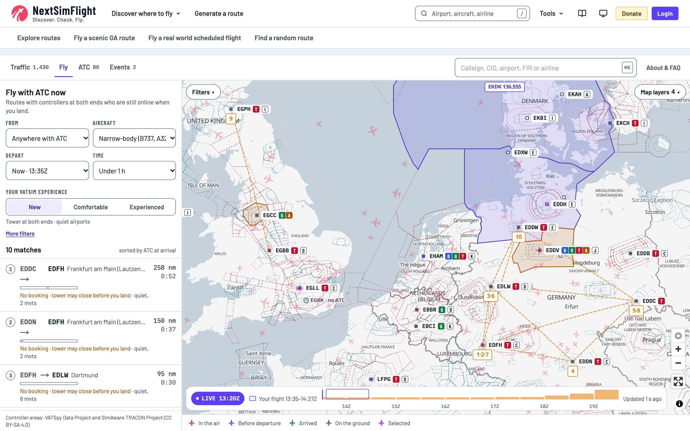
Finding a flight with ATC should be easy, so I built Fly mode. It finds routes with controllers at both ends and tells you whether they are booked until you land. Every flight shows its ATC along the route, and every airport tells you who to call first.
Free interactive charts
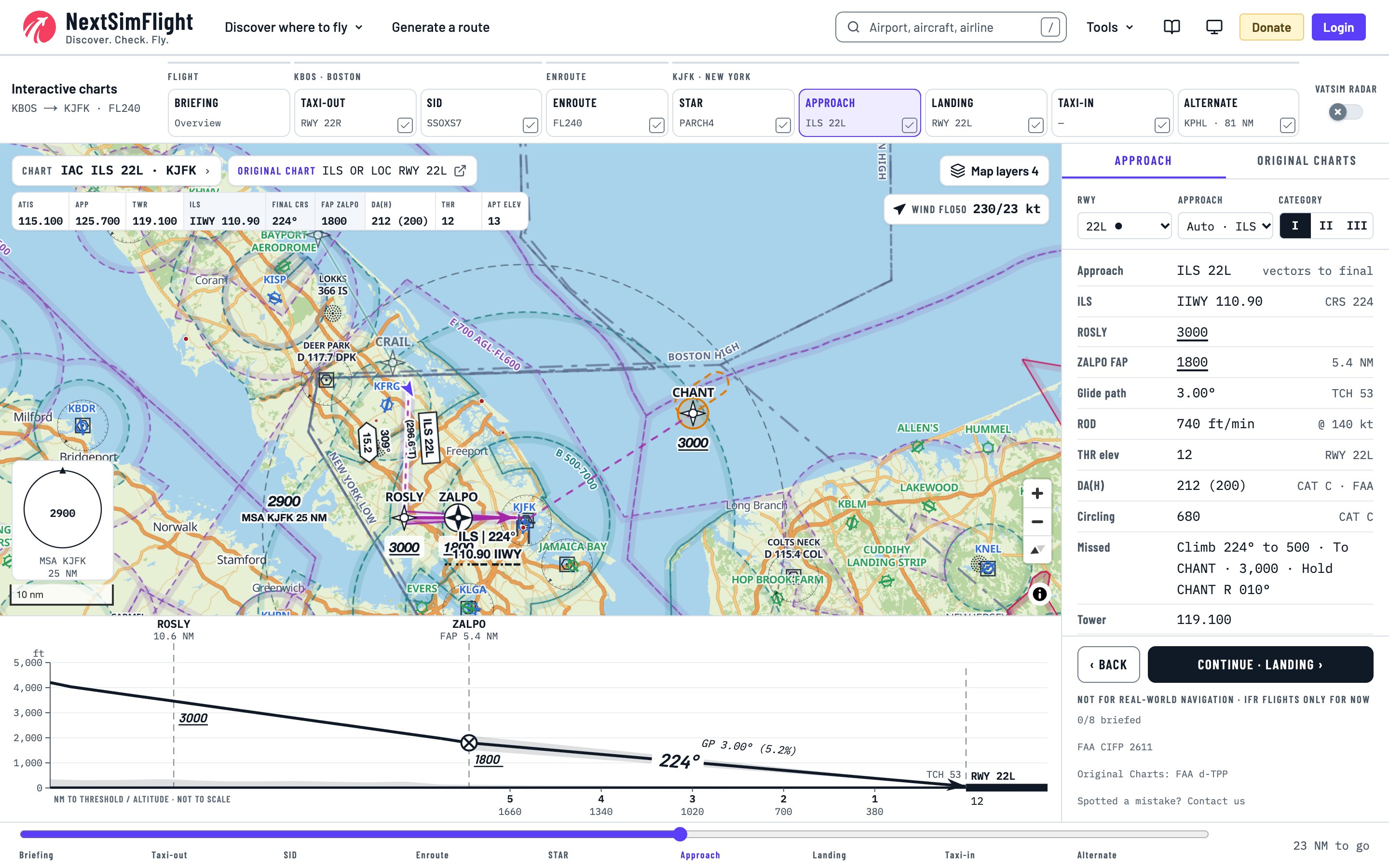
Follow your flight phase by phase, from briefing and taxi to approach and landing. Each phase brings its own map, vertical profile and frequencies, with the original charts one click away. Connect NSF Link and your aircraft appears on the chart, while the phases follow your flight.
Taxi routes from stand to runway
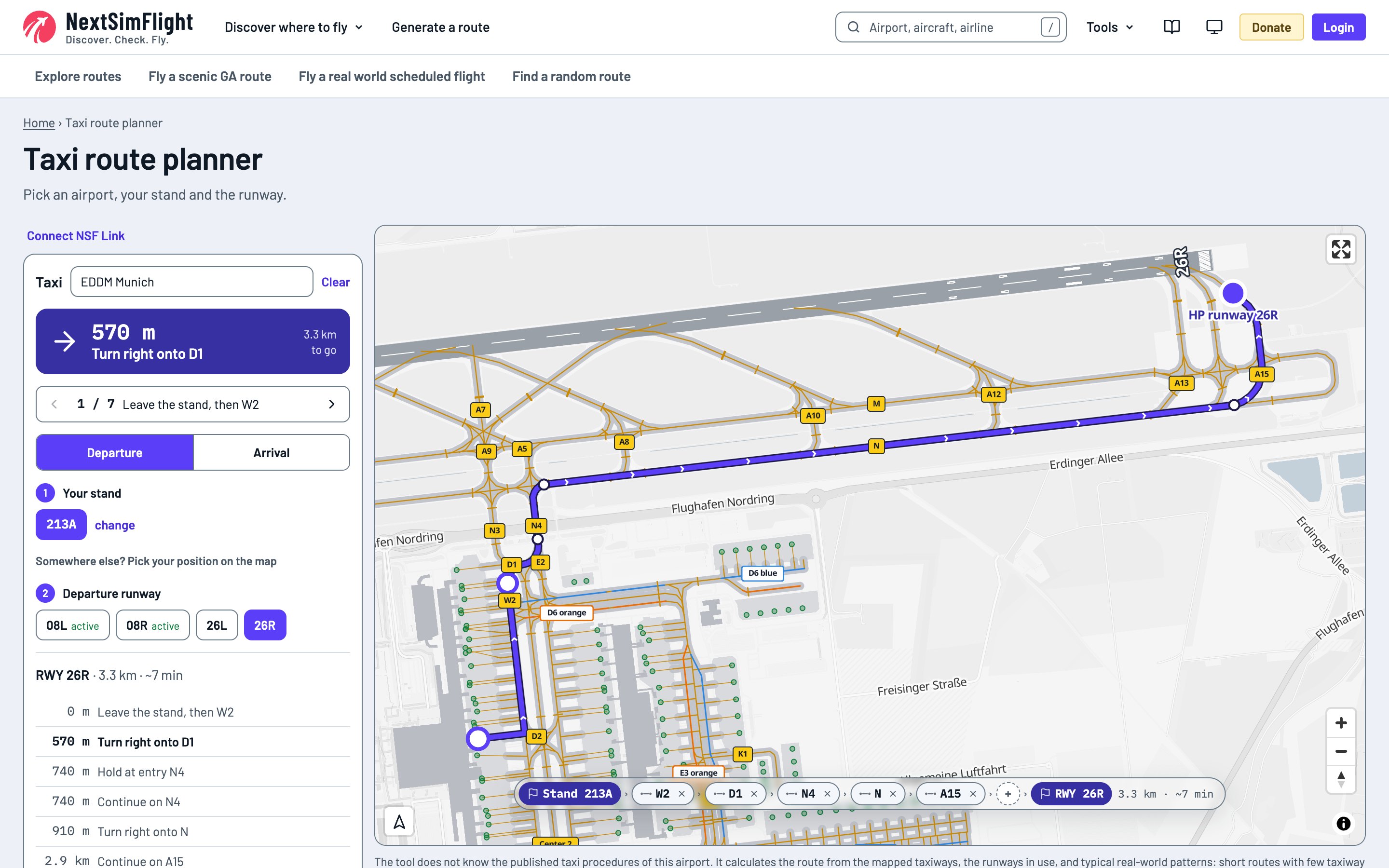
Pick an airport, your stand and the runway, and get a taxi route with every turn and hold. Drag it to change it, or follow it live with your aircraft from the sim.
And much more
- Live sim map with NSF Link
- NOTAMs on your route
- Past weather
- Aircraft pages
- Checklists for 70 aircraft
- Fuel and weight & balance calculators
- Nearest airport finder
- FOV calculator
- A full manual
NextSimFlight is a one-person project, made with love in Munich.
Stand by.
Screenshots from the development version, details may change before release. For flight simulation only, not for real-world navigation. Map data © OpenStreetMap contributors. Airspace data © openAIP (CC BY-NC). Radar: EUMETNET OPERA (CC BY 4.0), Radar-DPC (CC BY-SA 4.0). Weather: NOAA, aviationweather.gov. ATC areas: VATSpy Data Project and SimAware TRACON Project (CC BY-SA 4.0). Procedures in the chart example: FAA CIFP.